Licensing on a map, not just in a spreadsheet
See where your sites are, the licenses and environmental data for each area, and how projects relate to the territory.
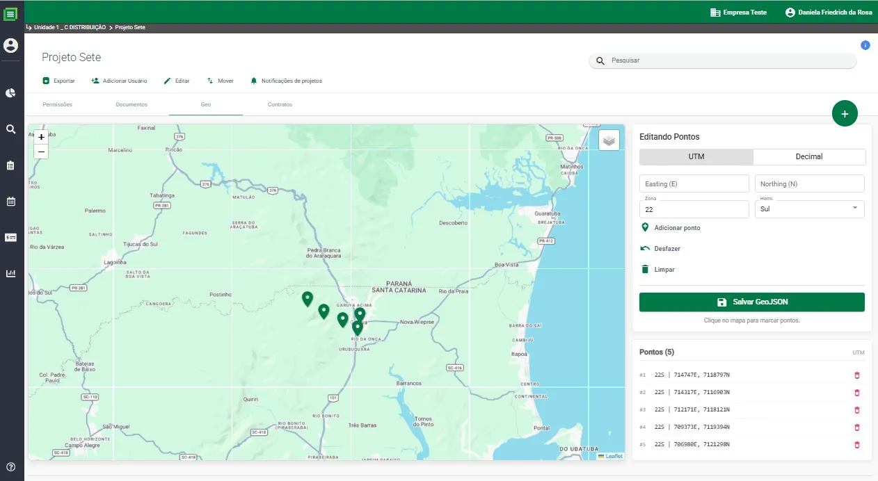
What you control
Geolocation
See sites and environmental licensing processes on an interactive map. Get a geographic view of the licenses, projects and environmental information for each area.
- Sites located on the map
- Environmental data by area
- Links between projects and territories
- Support for territorial management in licensing
Why it matters
What changes day to day
Licensing is about territory
The competent agency, restrictions and permit conditions depend on where a site is. Seeing the portfolio on a map reveals what a list cannot.
Portfolios spread across the country
If you operate in several states, the map shows at once where your licenses are and what is happening in each area.
Projects and territories connected
Linking projects to areas supports territorial management, from site selection to operations.
Related modules
Interactive dashboards
Your company’s licenses, permit conditions and deadlines at a glance, in real time.
Learn moreDocument management
Licenses, studies and evidence in one place, audit-ready.
Learn morePermit condition tracking
Every permit condition with status, deadline, owner and proof of compliance.
Learn moreFAQ
Geolocation
Can I see all company sites on the map?
Why does a geographic view matter in licensing?
See geolocation in action
We will show you the module with the licenses and permit conditions of your operation.